Visualizing the unknown Balkan
About the Project
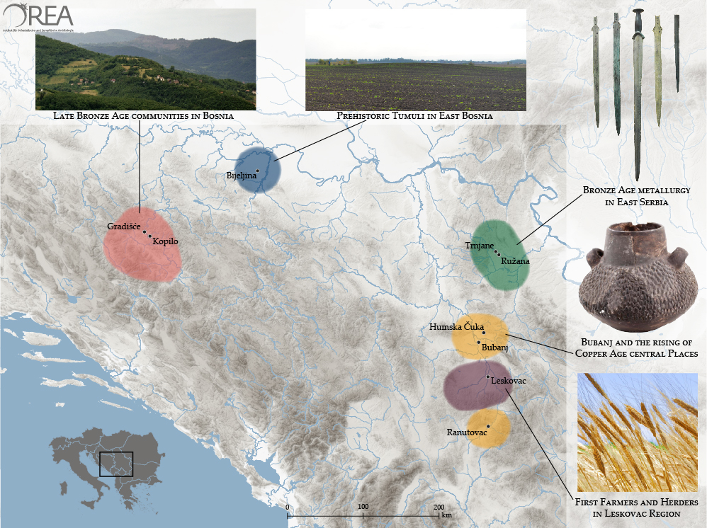
The aim of this project is to take an innovative and explorative approach to understanding of the past in the Balkans by assembling the results of cross-border and diachronic archaeological research with the use of responsive, wide-ranging visualization tools. With their turbulent history, unique geographical and ethnical diversity and intermediary position between Central Europe and Mediterranean, the eclectic region of the Balkans represents a true challenge for comprehensive humanistic studies aiming to provide an extensive and holistic.
The basis for the feasibility of the project are the research actions and cooperations of the OREA Institute as one of the very few archaeological institutions worldwide with a strong focus on the prehistory of the Balkan Peninsula. The digital reconstruction of sites and ancient landscapes will combine the results of the achieved archaeological work and employ new datasets from geophysical prospections, field surveys and mapping (GIS) in cross-cultural and diachronic perspective. The interdisciplinary actions will generate large amounts of new and essentially missing data that will uniquely incorporate archaeology, geoscience, cartography and digital visual media.
Project start- and end date: 01/03/2018 – 28/02/2020
Funding: Innovation Fund “Research, Science and Society” of the Austrian Academy of Sciences